 |
| Around the Alpine Zone |
We grabbed our camping and hiking gear and made our way to New Hampshire. After camping for a night we woke up bright and early to start the adventure! Unfortunately, we started late since I failed at alarm setting. We arrived at Pinkham Notch Visitor Center by 7am.
We knew there was a storm coming and checked the weather before we left the campsite, however we also checked at the visitor center with the rangers who work there. They said we would be ok but the sooner we got to the top and down the better.

7:35 we started! This 4.1 mile hike is estimated to be 8-10 hours round trip. We planned to go up Tuckerman's Ravine and to go down Lion's Head.
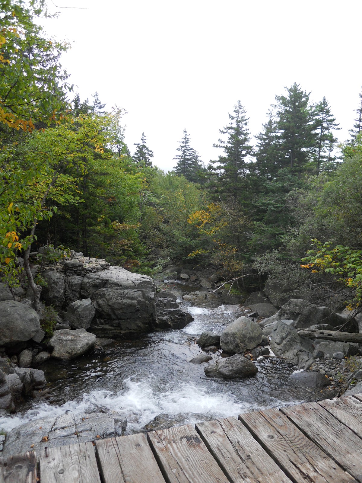 |
| Bridge and waterfalls! |
 |
| Rocky Path |
 |
| Another waterfall! |
 |
| 1.8 miles |
 |
| Ravine Floor, note the fog |
 |
| Some of the path above the Alpine zone |
 |
| This waterfall was actually to my left |
 |
| Its steep! |


You can see how the trail becomes much steeper. The rocks were also getting wet and slippery with the incoming fog/cloud cover so we have no pictures after this. But as you can see, fairly low visibility.


We had talked with people as they were hiking down the mountain to see if conditions were normal or if we should be concerned. At the summit ranger station lots of people were having the same discussion.
We decided to hike down, but when the wind started to blow us off the path a few yards into the trail, we thought better of it. This was disappointing, but we were too uncomfortable with the weather and with our limited knowledge of the mountain. The mountain will still be here next season. So we went to the souvenir hut, bought shuttle tickets, and took the Auto Road back. Don't plan on taking the shuttle back, there are situations where the shuttle isn't running.
What is was our fitness and hiking level?
I can run almost 3 miles and hiked Mt Monadnock fairly easily. I thought the trail was challenging, but if you go slow it is manageable. The challenge was the constant incline and altitude, as well as the loose rocks. Since I never hiked this mountain before, I was a little uncomfortable with the weather conditions since we didn't know if it was normal or if this was an impending storm situation. I was sore that afternoon and the next day, but it was a dull ache, it wasn't horrible.
My friend was training to run a marathon and is on a whole different level and has been on multi-day hikes before. This was her first time hiking in the White Mountains.
What did we wear/pack?
The least amount of cotton clothing as possible.
Going above the treeline we were instructed to always pack gloves and hats
Bring a map and compass, also know how to use them! Maps are waterproof now too!
I wore nylon spandex pants, hiking boots, wool socks, north face wind breaker, and a tank top.
So in our backpacks: map & compass, flash lights, first aid kit, duct tape, extra wind pants, a fleece and sweatshirt, wool socks, scarf, hat, gloves, 2L of water (you can fill up at the summit), peanut butter sandwiches (2-3), lots of trail mix, about 10 granola bars, and jolly ranchers
Next year... we will be back to hike Mt. Washington round trip!
No comments:
Post a Comment