What an eye opening amazingly great vacation! Anthony and I spent a week checking out a few of the beautiful natural wonders in the United States. We saw parts of Black Canyon of the Gunnison, Mesa Verde, Canyonland, and Arches. We also stood at the Four Corners, saw the milky way, and saw Natural Bridges National Monument.
America the Beautiful National Park Passes: These are on the pricier side ($88/annual pass) but if you are planning on going to a few parks then it will quickly be worth it. Park entrances can be $20/vehicle. If you don't want to spend the money you can get free ones if you are in the military, if you volunteer certain hours with the parks, or have a permanent disability. There are also $10 non-expiring passes for being a senior citizen.
Flying out to Grand Junction, Colorado
We flew out early on Wednesday morning so we could have a whole day of exploring. Unfortunately there was an issue with the plane being over weight so they had to take some folks off the plane before we could take off. We missed our connection (landed at 5 pm instead of 10:30 am and lost a whole day) but United was great at redirecting our flights and luggage.
Some of you may know, I don't trust checking luggage so I was quite relieved when both giant duffle bags of camping gear and clothes made it to the final destination even with 2 connections instead of the original 1 connection.
Luckily, I did not book any camp sites for us and we had an extra day built in for additional exploring, so we had a lot of flexibility for timing and it worked out great!
Car Rental
We rented from Thrifty because we thought they would give us a Jeep. Instead, we had a Nissan Rogue. While this was perfect for 2 people and lots of gear, we really wanted the 4 wheel drive so we could do some of the off road trails. This was a big disappointment especially at Canyonlands National Park and Arches National Park where most of the park is available only by 4WD roads. If you have the option to get the 4WD, do it, but at the same time I think we were able to see everything we had wanted.
Groceries
After we picked up the rental car we went to the grocery store to pick up food, ice, propane, and wood.
We planned out our meals for several reasons 1) cost savings 2) flexibility 3) I wanted to try the stove attachment for the propane tank. I won't lie, we did bring some food with us like jerky, crackers, cheese, cereal, bread, spices, and tin foil since we already had them at home.
I did have to buy a bottle of olive oil, next time I will bring some from home in a small container. I only used a few tablespoons and had to throw out the whole container since we didn't want to pack it in the checked luggage.
I wasn't planning on slaving over the fire for hours on end, so I tried to plan easy not messy meals:
- Spicy Sausage with Onions, Peppers, and Potatoes (2 meals)
- Sliced up Sausage with cut veggies in a tin foil packet with olive oil, salt, pepper, garlic powder. Cook on the fire 30-40 minutes.
- Tristrip(?) Pre Marinated Steak with Asparagus (1 meal)
- Steak in a foil packet. Cook 30-40 minutes.
- Cut asparagus into 1-2 inch pieces, toss with olive oil, garlic powder, salt, and pepper. Put in a foil packet. Cook 20 minutes.
- Taco meat nachos (1 meal)
- Tuna sandwiches with mayo packets
- PB and J sandwiches
- Hard boiled eggs
- Scrambled eggs
- Cheese and crackers
- Water - Most of the parks did not have running water available so we purchased 12 gallons of water for the week for the two of us, I didn't drink enough water so we ended up with about a gallon of water unused.
Gear Review
- Suisse Sport Adventurer Mummy Ultra-Compactable Sleeping Bag - These are supposed to be good for 30F, but since I used it in 30F with 4 fleece blankets and wearing cold weather compression gear... I'd go with 40F or warmer with this bag! But the material was fine, the zippers were ok, and the bag was comfortable.
- ALPS Mountaineering Lightweight Series Self-Inflating Air Pad - Regular size, this was comfortable and really makes a big difference compared to sleeping directly on the ground. If it doesn't inflate right away you can blow into air nozzle and it will puff up nicely.
- ALPS Mountaineering Compression Sleeping Bag Stuff Sack - Medium size, one of the sleeping bags didn't come with a bag so I purchased this one. This was a great durable bag. The clips were strong and I was able to fit both sleeping bags in the bag.
- Coleman PefectFlow 1-Burner Stove - This comes in two pieces, the base and the metal top that screws into the propane tank. The metal top was bigger than I expected and you could use a normal 9 inch pan. The metal top cools quickly which was nice. It was slightly challenging to pack as I was worried about the temperature nozzle sticking out and didn't know if it would cause problems if it was jostled. The only issue I had was controlling the temperature, low was still kind of hot. But if you are trying to boil water, this was great because it will heat food up fast without using too much propane.
- Polar Bear 24 Pack Soft Cooler - I was looking for a cooler that would be easy to transport and keep meat cold for several days. Soft coolers are notorious for not keeping items cold for more than a few hours or at most a day. But I was I was very impressed with the durability of the exterior cooler. The fabric was a tough canvas and the inside is lined and waterproof. The zipper was very solid feeling as well. While I had planned on packing the cooler, the cooler didn't pack down as small as I had hoped so we filled it with clothes and gear then used it as a carry-on. As the weather stayed fairly cool during the trip we didn't need to get more ice until the 5th day!
Black Canyon of the Gunnison National Park, Colorado
 This was a surprise National Park. In my guide book it shows up under the Rockies section instead of the Colorado Plateau. I was looking at the drive from Grand Junction to Mesa Verde when I saw a little patch of green on the map. Eureka! It is another National Park! It was only an hour away so I figured why not? This was such a great surprise! The park was beautiful and so different than other parks.
We arrived at the Black Canyon of the Gunnison National park around 6:30pm. Going into the park we passed a few hotels and some fast food places. It was cold, getting dark, and all the sites were covered in snow! We drove around the campground (no entrance/camping fees for winter) to see if there were any sites that were not muddy and were shoveled. But a quick trip around Loop A proved the ground was actually still frozen. We picked a site near the bathrooms (very clean pit toilets with hand sanitizer, no running water in the park) and started to unpack.
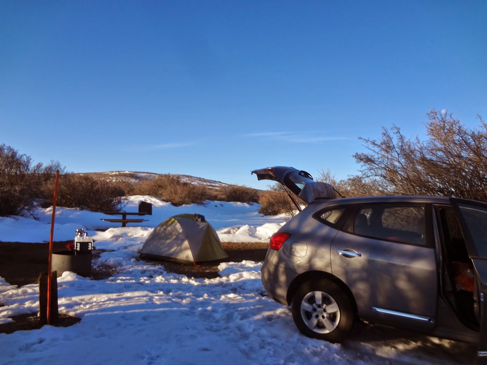 Anthony quickly set up the tent and I tested out our stove attachment! As the sun was setting, I was pretty convinced that there were all sorts of wild animals hiding the trees and behind the snow banks. I was rather jumpy, especially in the huge silence. The only noises were the ones we were making.
We made quick work of the food and then cleaned up. I made sure to put the clothes I cooked in back in the car. There are bear boxes for food and trash, so we wanted to be careful. Between the jet lag, the travel exhaustion, and the lack of campfire, we went to bed early. We did poke our heads out later on that night to see the stars. The stars were bright but the moon was so bright that I was surprised to find out that there wasn't a light on the tent!
We woke up early/got up after a chilly night of 15F and went to the visitors center. We read the exhibits, watched the movie, and learned about this little known national park. The 20 minute movie was very informative and I recommend checking it out at the beginning of the visit. It tells you how it was found, has great scenes, and how the park is important now.
 Keep in mind that during the winter the South Rim road is closed for winter activities with maintained cross country ski trails and show shoes are available to rent in the visitor center. If we had more time we would have walked out to see some of the canyon overlooks. The North Rim road is also closed for winter weather.
We are going to try and make our way back out there in the warmer weather to view the canyon and be able to do a few other hikes. The area is very steep and only experienced folk should hike down into the canyon.
Fun Facts (from the guidebooks, nps.com, and the visitor center)
- 20,000 visitors a year
- Established Oct 21 1999
- Deeper than it is wide in some areas
- Was formed by uplifted hard rock and then cut with slow continuous erosion of fast moving water
- The 48 mile river drops an average of 96 feet per mile and 480 feet in one two mile stretch
- The first explorers to successfully navigate the area used rubber air mattresses
- The narrowest part of the river is 40 feet across
 After spending sometime warming up we set out of a couple very short hikes. The first hike was a short mile hike from the back of the visitor center and goes to a scenic overlook that juts out into the canyon. It was short, easy to get to, not super steep. It is along the edge of the canyon and there are areas that do not have railings, so watch your footing!
The second hike was Rim Rock Nature Trail (1 mile round trip) that starts at the visitor center parking lot and ends at the campground. We didn't do the whole walk but we were able to get a closer look of the depth of the canyons and soak up the view.
Mesa Verde National Park, Colorado

 Three hours south of the Black Canyon is Mesa Verde National Park. This was the home to the ancient Puebloans and they built their homes into the walls of the cliffs using mud and rocks. Since being discovered in 1888 by some cowboys lost in a snowstorm it is estimated that the Puebloans lived there for about 75-100 years after building their cliff dwellings, without leaving any indication of why they left. Opened in 1906, the park has over 4,800 archaeological sites, that includes over 600 cliff dwellings and sites date from A.D. 550 to 1300. There are approximately 600,000 visitors a year.
Mesa Verde National Park has had many many wildfires in the past and there are still charred areas where you can see the trees and vegetation starting to come back. In fact, most of their service roads are for fire prevention.
We found a great A&A Mesa Verde RV Park just outside the national park. They opened early for the season which was great for us! There was only one other person in the campground.
 The spaces were big with campfires grates and picnic tables at each site and there were trees or awnings available for shade. Also available was a dish sink, washer and dryer, a pool, mini golf course, hot tub, free wi-fi, and a playground. The bathrooms were clean, the water was hot, the staff was friendly, and the park was far enough from the road you didn't hear all the cars going past. We were in a shaded area and it was perfect for our tent. Thank you for an excellent stay!
  After setting up the tent we went to explore the park. We started with the Chapin Mesa Museum. There were many artifacts such as pottery, basket weaving, tools, arts, and crafts as well as a bunch of dioramas (yes, think shoe boxes and figures but on a huge fancy scale). I also recommend the 25 minute intro movie to give you a basis of historical background. We grabbed a map, watched the movie, then went to explore Spruce Tree House.
There are several cliff dwellings to explore, but since we were there in the winter, most was not open. To get to the Spruce Tree House you walk down a ½ mile paved (rather steep) sidewalk with a couple switchbacks to get to the bottom where the house is located. There was a ranger on hand to ask questions and we were able to pick up a guide book. If you return it you don't have to pay, they use the honor system.
 |
| It was a tight squeeze! |
Next we drove the Mesa Top Loop which takes you around many kivas, pithouses, and early pueblo villages. The road goes past some great views of the cliff dwellings. It was recommended that we do this in the afternoon as the lighting would be better for viewing the cliff dwellings across the canyons.
Once the sun started to set we went back to the campground for dinner and to plan the next day.
 While the night dipped to 30F, during the day it was 50-60F.
We woke up early and drove back towards the Chapin Mesa Museum. Just before the Spruce Tree House there are two trails. The Petroglyph Path Loop and Point Lookout.
 We started with the 2.4 mile Petroglyph Path loop. It is estimated to take 2 hours, but we did it in an hour and a half. The trail goes along the inside of the canyon, it includes were some steep stairs and tight squeezes between rocks. A nice touch that is throughout this park is that most of the plant life is labeled so you can have an idea of what you are looking at.
If you want a short version, do the reverse of the trail. There is a mostly flat walk, a rock scramble down to the next path, and the petroglyphs will be right there. There is no note at the beginning of the trail warning about the steepness or the rock scrambles, so check with the ranger if you have any concerns prior to beginning the hike.
What is a Petroglyph and what is a Petrograph? A Petroglyph is a carving into rock and a petrograph is an image drawn or painted onto rock.
 |
| Point Lookout |
The last stop at Mesa Verde National Park was Point Lookout. A 2.2 mile hike estimated to take 2 hours. The trailhead is at the back of the campground in the amphitheater. The campground was closed so we were the only one on the trail at that time. We half ran the trail and it took us about 30 minutes to the top and 30 minutes back down. There was a great view but if you only have one day at the park and are not able to explore too much, see the houses and there are plenty of views on the drive out to the museum.
We left Mesa Verde and continued heading southwest. The landscape is starting to flatten out and we are heading into the desert! One hour later we arrived at Four Corners. We thought it was a National Monument, but it was on Navajo reservation land.
Two items of note: 1) its a tourist trap 2) its not the actual intersection point.
 We paid $6 to get into the area. We parked and followed the masses into an area surrounded by stalls. There were a few Native Americans selling items like dream catchers, magnets, postcards, and knickknacks. In the middle of all the stalls was the metal circle that all tourists are looking to take their picture with it.
Luckily we were off season, I can't imagine touching that hot metal circle that was baking in the 100+ degree sunshine. I also can't imagine waiting in line to take my picture with the circle. After about 5 minutes we went to go read some of the plaques that lined the area. The plaques noted that this was not the actual intersection point but is the one most often used. The original boundaries were off due to the tools and manual measurements of the 1800s.
Long story short, no need to go.
We drove to the entrance, read the warnings (bubonic plague area(?!), stay away from mice, look out for snakes, etc), then went to find a campsite. There are only 13 sites available for tents and for RVs. All of them were filled that night! This was one of the most beautiful campgrounds I have been too. Our site (#4) overlooked a mountain range, had the sunrise and sunset, and trees blocking the other sites. The site had a picnic table, fire place and grate, and a sandbox for the tent. The bathrooms were pit toilets with hand sanitizer. There is no running water other than the visitor center.
 |
| Owachomo Bridge |
Anthony started to set up the tent then to make a fire and I started to unpack and get dinner ready. This was such a peaceful evening. As the fire was dying down we were taking periodic looks at the sky. Yes, this is where we saw the Milky Way. It was a stripe of foggy stars across the sky, faint, but it was there! We learned that in the winter we are facing out towards the galaxy so the stars are lighter. The moon was also very bright.
"We live in the Milky Way Galaxy, this means that every time we gaze at the night sky we are looking at the Milky Way Galaxy. More exactly the spiral arm closer to the galactic center one part of the year and in the other part we see the near edge of the spiral arm farther from the galactic center. Due to nebula and dust clouds, we can’t see the center of the Milky Way (in visible light) at any time." http://www.youcanseethemilkyway.com/ (also has light pollution map and more information)
Natural Bridge is 40 miles from the nearest town, that that nearest town is rather small. What makes Natural Bridge so special? It is one of three places in the united states with zero light pollution. In the summer they do telescope events. There are only 13 sites available on a first come first served basis. So I'm not sure what you do if you go out that way and there are no places to stay.
The night dipped to around 30F but during the day it was 50-60F. The next morning we packed up then worked on the paved 9 mile scenic drive. If we were staying longer there is a 8.6 mile loop that will have you pass each bridge Owachomo, Sipapu, and Kachina. During the drive we got out at all the scenic overlooks but also did the walks down to the main bridges when available. The scenic overlooks have a mix of paved walkway, uneven stone steps, even ladders!
After the drive we went to check out the visitors center.
Lucky we did as the ranger was able to help us plan the rest of our trip! We had concerns about having enough time to explore Arches (1 day or more?) and Canyonland (huge place and entrances to different districts are not near each other). He recommended we go to explore the Needles District, then drive up to Moab for the night. Explore Arches, and then do Island in the Sky district of Canyonland.
Final note, we did see a couple bugs starting to come out for the summer. We noticed because so far there haven't been any bugs out! I don't know if the area is very buggy during the summer.
Final note, we did see a couple bugs starting to come out for the summer. We noticed because so far there haven't been any bugs out! I don't know if the area is very buggy during the summer.
 |
| Newspaper Rock Archaeological Site |
Canyonland is a huge national park with three main areas: Needles, the Maze, and Island in the Sky. The park is split by the Colorado and Green Rivers. Established in September 1964 this park is mostly undeveloped. If you had a car with 4WD this would be a place to have one! There are many full day and overnight backpacking hikes in this region. In the past, the park was used for mining uranium in the and for cattle ranchers. Specifically the growth of America's nuclear arms program created a high demand for uranium in the 1950s. The impact of these activities can still be seen today in the grounds and roads they used.
This region only gets an average of 10 inches of rain a year and we were there for one of the storms! Clouds rolled in, the temperature dropped 30 degrees, and the rain came down. This lasted for about 15 minutes until blue skies suddenly appeared and the temperature came back up to the 60s! But that was the extent of rain for the whole week!
We arrived at the entrance of the park and went right to the visitor center. We chose to do the Chesler Park Viewpoint hike which was about 6 miles (or if you have more time do the loop for 11 miles) and it took us 2 ½ hours with a 30 minute break at the turn around point. To get to the Elephant Hill trail head you drive on a paved road that changes to a single lane, winding, bumpy, up and down dirt road and ends in a parking lot. I don’t recommend taking an RV or a having a trailer hitched to your car for this drive.
This was a great hike! The path was a lot of ups and down, some tight squeezes between rocks, across several flat parts, and among into the needles. There are limited trail blazes (rock piles) so pay attention to ensure you stay on the trail. It would be very easy to get lost. Bring lots of water, sun block, a hat, and layers as the weather can change drastically between shade and sun. There was also a breeze so you didn't feel the sun.


This was a great hike! The path was a lot of ups and down, some tight squeezes between rocks, across several flat parts, and among into the needles. There are limited trail blazes (rock piles) so pay attention to ensure you stay on the trail. It would be very easy to get lost. Bring lots of water, sun block, a hat, and layers as the weather can change drastically between shade and sun. There was also a breeze so you didn't feel the sun.
As we drove out of the park we drove over to the Big Spring Canyon overlook. If we had more time I think I would have liked to do the hike. Then we left to head up towards Moab, UT to go check out Arches.
 |
| Balance Rock! |
We went next door for dinner at Buck’s Grill House. Anthony picked this place as they had been showcased on the Paradise Food. I had a veggie burger and Anthony had a regular burger. It was a little expensive, but filled us up!

Seven hours was plenty for us. Almost all the overlooks had crowds and lines to take pictures. We felt this took away a lot of the experience so we didn't linger at most spots. On the other hand, if you are interested in auto touring, all of the overlooks are short hikes (15 minutes or less), potentially paved walkways, and you don't need to leave your vehicle for very long. I could see this as a definite perk during the summer months.
 |
| The North and South Windows |
Balance Rock, 10 minute walk around hike on a gravel trail
The Windows/Turret Arch/Double Arch, 30- 60 minutes, trail varies from paved to rock scrambles
Landscape Arch, 45 minutes, 2.1 miles, very pretty but can't get close due to a recent bridge collapse.
 |
| Landscape Arch |
 |
| Delicate Arch |
 |
| Delicate Arch |
At the end of the day we drove out to next Arch View RV resort which is closer to the Island in the Sky entrance.
One day was plenty for us. We started the morning with a sunrise hike to Mesa Arch, 1 mile round trip, easily followed path. This was very crowded and we showed up about 40 minutes before sunrise. There were about 40 people there. Was it worth it? Maybe, but you could probably scout out some other east facing arches to view. The concept of seeing the park for the first time as the sun came up over the mountains was very exciting.


Grand View Point Overlook; easy 2 mile hike. This was a flat trail with occasional stairs carved into the rocks. Great views of the canyons on either side and you can also see the Needles district off to the distance. One of the interesting parts of the landscape is that you can see the old roads that were used by ranches and for mining.

Upheaval Dome Overlook Trail, 1.8 miles, easy hike with rock scrambles. They do not know what caused this crater but it was very cool. The inside of the crater is a different material then the outside of the crater. There is one scenic viewpoint that is easy to get to and only a .4 mile walk. However, if you go to the second overlook there is a much better view. Follow the rock cairns, this path is over the rocks and there is a little bit of scrambling involved.

One of the last activities we did was the 4WD road to Goose Neck Overlook. We had an incredible view of the Colorado River.
 |
| Switchbacks of the dirt road |


Arch View RV resort was hot. There was no shade and the grills are set up under trees so I was worried we were going to set a tree on fire the whole time. If you go in the summer bring a tarp or something to sit under. The bathrooms were ok. We would stay there because the convenience of location.
Our last stop on the way to the airport, we did the 23 mile Historic Rim Rock Scenic Drive. This takes you through lots of beautiful scenary, a cool echoing canyon, and a bit of historic information along the road.
Cryptobiotic soil is easily damaged from people walking on it. Of many years the untouched soil houses lots of desert algae turning it into a crumbly mound that looks similar to lots of small ant hills. This is very important for the ecosystem and with giving the desert plants a chance to live.


CONCLUSION
Well, thanks for following along on our wonderful excursion! We had a great time and are excited for our next adventure! I hope this has motivated you to go and explore some of the natural wonders that exist in our own country! Let me know if you have any questions! Happy Travels!!!
